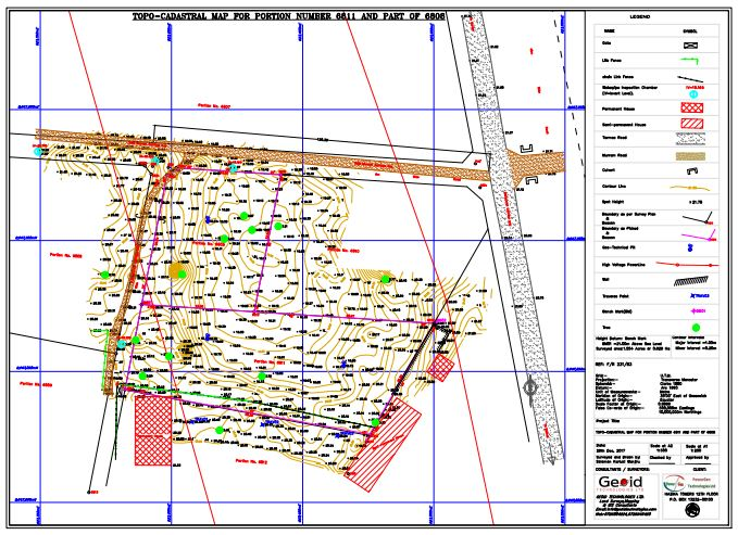
Topographical surveys is a branch of surveying which involves the process of ascertaining and representing upon a plane surface the contours of the ground and existing features on the surface of the earth or slightly above or below the earth’s surface (i.e. trees, buildings, streets, walkways, manholes, utility poles, retaining walls, etc.). We carry out land, topo surveys, map production, contours and 3D i.e. longitudinal & cross-section profiles